
Earth
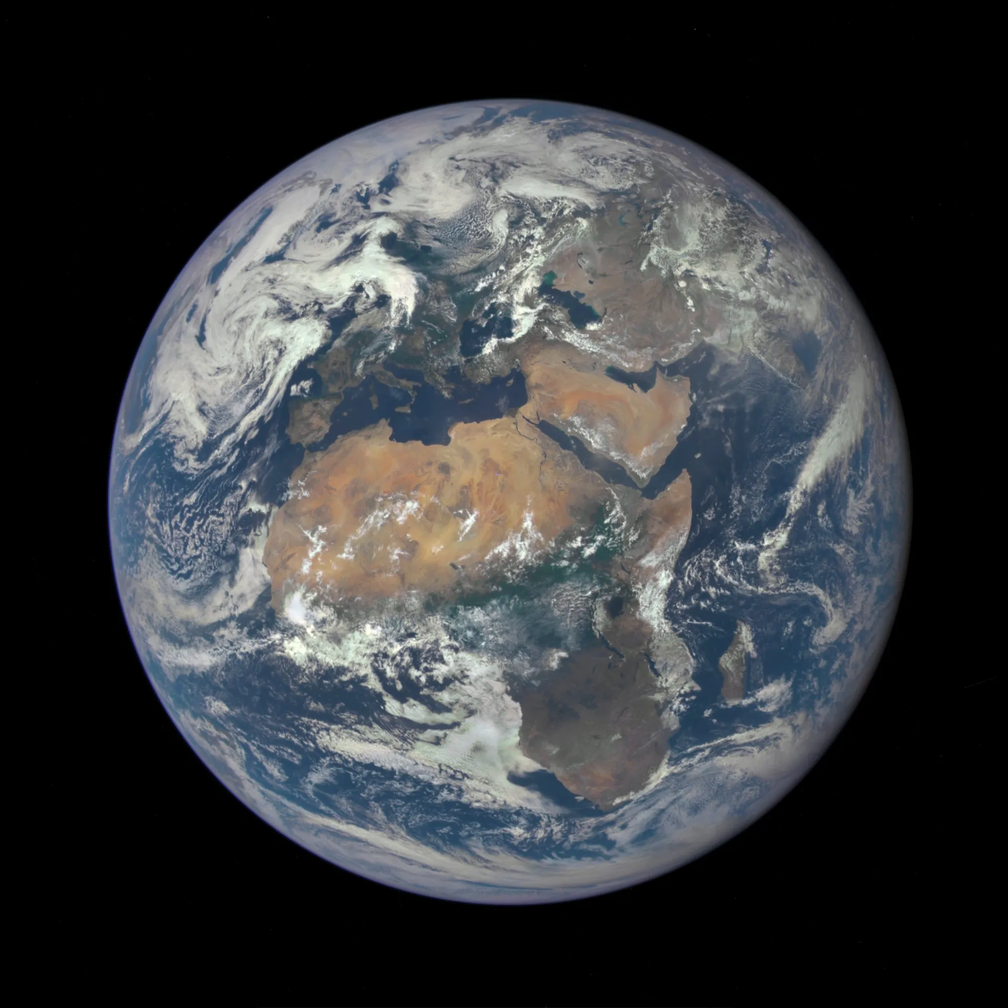
Earth is the densest planet and the only known home of life: 12,742 km wide, 150 million km from the Sun, tilted 23.4° and 71% ocean.
NASA
The only world we know of with oceans on its surface, a breathable atmosphere and life.
Earth is the third planet from the Sun and the largest of the four rocky planets. It is the only place in the universe where life is known to exist, thanks to liquid water, a protective atmosphere and a steady supply of sunlight.
How big is Earth?
Earth’s mean radius is about 6,371 km, giving a diameter of roughly 12,742 km. It bulges slightly at the equator because of its spin: the equatorial radius is 6,378 km and the polar radius 6,357 km. A trip around the equator is about 40,075 km.
Its mass is about 5.97 × 1024 kg. With an average density of 5.51 g/cm³, Earth is the densest planet in the solar system. Surface gravity is 9.8 m/s², the yardstick against which every other world’s gravity is usually compared.
How far is Earth from the Sun?
Earth orbits the Sun at an average distance of about 149.6 million km, a distance called one astronomical unit (AU). The orbit is a slightly flattened ellipse. Earth is closest, about 147.1 million km, in early January and farthest, about 152.1 million km, in early July.
It travels at an average of 29.8 km/s, more than 100,000 km/h. To leave Earth for good, a rocket needs to reach about 11.2 km/s, as explained in Escape velocity.
How long is a day and a year on Earth?
Earth spins once relative to the stars every 23 hours 56 minutes 4 seconds, the sidereal day. Because Earth also moves along its orbit, it must turn a little extra to bring the Sun back overhead, which gives the 24-hour solar day. One orbit takes about 365.26 days, which is why calendars add a leap day almost every four years.
Earth’s axis is tilted about 23.4° to its orbit. That tilt, not the change in distance from the Sun, causes the seasons: each hemisphere has summer when it leans towards the Sun. See Seasons and Days and years.
What is inside Earth?
Earth has four main layers:
- Crust: the thin rocky skin, about 5 to 10 km thick under the oceans and up to about 70 km under mountain ranges.
- Mantle: hot rock about 2,900 km thick that flows very slowly over millions of years.
- Outer core: liquid iron and nickel. Its churning generates Earth’s magnetic field.
- Inner core: a solid iron-nickel ball about 1,220 km in radius, with a temperature similar to the surface of the Sun.
The crust is broken into tectonic plates that move a few centimetres a year. Their collisions and separations build mountains, open oceans and cause most earthquakes and volcanoes. Earth is the only planet where plate tectonics is known to be active today.
What is Earth’s atmosphere made of?
The air is about 78% nitrogen, 21% oxygen and 0.9% argon, with small amounts of carbon dioxide, water vapour and other gases. Sea-level pressure averages 1,013 hectopascals. The global average surface temperature is about 15 °C.
The atmosphere keeps temperatures steady between day and night, burns up most small meteoroids and, through the ozone layer, absorbs much of the Sun’s ultraviolet light. The magnetic field adds a second shield by steering charged particles from the solar wind around the planet. Where some reach the upper air near the poles, they make aurorae.
About 71% of the surface is covered by oceans, which hold about 97% of Earth’s water. Earth is the only planet known to have stable liquid water on its surface, although moons such as Europa and Enceladus hide oceans under ice.
How did Earth form?
Earth formed about 4.54 billion years ago as dust and rock in the disc around the young Sun clumped together. Early in its history a Mars-sized body is thought to have struck it, throwing out debris that became the Moon.
Simple life appeared surprisingly early. The oldest widely accepted fossil evidence is about 3.5 billion years old, and some scientists argue for older signs, which are debated. Over billions of years, microbes added oxygen to the air, which eventually allowed complex life to evolve.
How have we studied Earth from space?
The first American satellite, Explorer 1, launched in 1958 and discovered the Van Allen radiation belts. Apollo 8 astronauts photographed “Earthrise” over the Moon in 1968, and the Apollo 17 crew took the “Blue Marble” picture of the whole Earth in 1972. In 1990 Voyager 1 looked back from about 6 billion km and captured Earth as a “pale blue dot”.
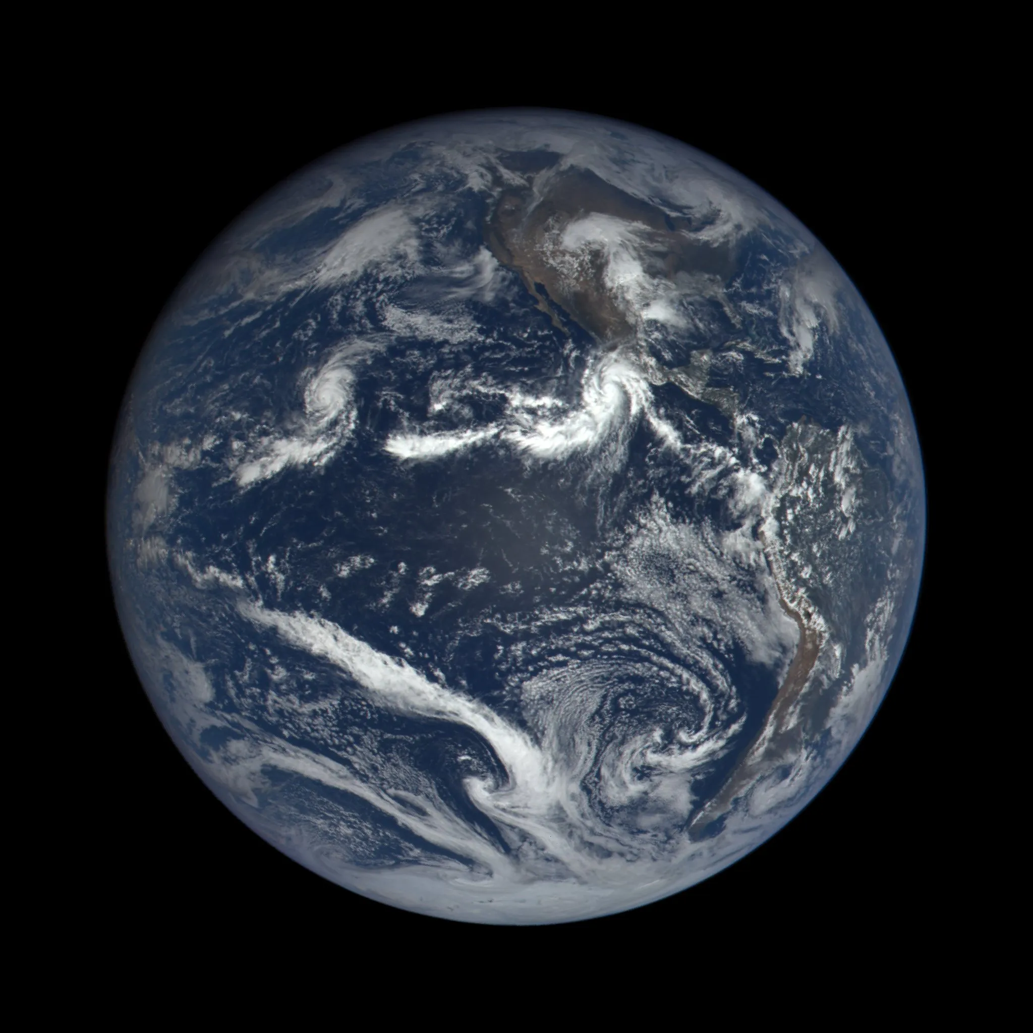
Today, satellites such as the Landsat series (since 1972) and Europe’s Copernicus Sentinels track forests, ice, oceans and weather. The image above comes from the EPIC camera on DSCOVR, launched in 2015, which views the sunlit face of Earth from about 1.5 million km away. Learn how spacecraft get there in Reaching orbit, or see Earth’s place among the planets in the orrery.
Moons in the knowledge base
Data sources
Tools and lessons use simplified models for learning only. They must not be used for navigation, mission planning or any operational decision. Certificates are free and non-accredited. Read the educational content disclaimer